Course description
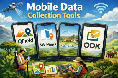
This course offers a comprehensive, hands-on introduction to modern mobile data collection and geospatial field data workflows using industry-leading platforms such as KoboToolbox, SW Maps, QField, and ODK Central. It is designed for learners who want to move beyond paper-based surveys and manual data handling into efficient, digital, and location-aware data collection systems.
Participants will learn how to design robust digital forms and surveys, including the use of validation rules, skip logic, and structured question types to ensure high-quality data. The course places strong emphasis on GPS and geospatial data collection, enabling learners to capture points, lines, and polygons, work with maps, and accurately record location-based information in the field.
The course also covers offline and online project management, teaching learners how to configure projects for use in low-connectivity environments, synchronize data securely, and manage multiple users and devices. Learners will gain practical experience in organizing field teams, monitoring submissions, and maintaining clean and reliable datasets.
By the end of the course, learners will be fully equipped to set up end-to-end mobile data collection projects, from form design and field deployment to data management and analysis. The course concludes with a capstone project, allowing participants to apply their skills to a real-world scenario and demonstrate competency. Successful completion of the capstone leads to certification, validating the learner’s readiness to use mobile data collection tools in professional and real-world contexts.